Saturday, September 14, 2013

Lake Valhalla & Lake Janus

September 14 - 15, 2013

Andy and I were itching to go hiking all week. Stumbled upon Lake Valhalla so decided to go there. The trail head is literally across from Steven's Pass so it was a quick and easy drive. Started our hike at 10 am and got up to the lake by 12:30 pm. It was a pretty easy one and we could not have asked for nicer weather. We were debating whether to go another 4.3 miles to Lake Janus to set up camp there since Lake Valhalla was so busy, but I decided we found a nice spot just above the lake so we stayed put. Let me tell you, there were a lot of new parents with their babies, lots of adorable doggies, and just a good amount of hikers in general. After having lunch with some bees and splashing in the water, we headed out on an ~8.5 mile day hike to Lake Janus. Again, there was quite a bit of stock manure and quite possibly bear scat but we did not encounter any bears. Lake Janus is lovely - serene and secluded with nice meadows surrounding it and some floating lily pads. The sandy shore at Valhalla is definitely much nicer, but if you wanted to be alone Janus would be the place to stay. After snapping a few photos Andy and I made our way back to camp just in time for dinner. We rehydrated up some delicious homemade chili mac and reflected on our total 14.5 mile day hike. I believe that's the most mileage we have done in one day. We were also hiking at a good pace that day.
You know what is also cool? We got to chat with a couple solo PCT thru-hikers on Saturday. One of them had a late start in May (people usually begin in April)and had just about 10 days left before he would make it to Canada and another hiker was doing the hike in reverse - heading to S. Cali or as far as he could get. Andy and my long-term/life's goal is to hike the PCT in one go. I asked my boss once if I could take six months off to hike the PCT to which he replied, "Sure, as long as you take the days off on the weekends."

Here are some of our lovely photos:

Lots of mushrooms growing on this trail. This one was cool - reminds me of "1-up" mushrooms in Mario Bros.

Beautiful meadows - perfect for stock animals to graze.

Lake Valhalla and Lichtenberg Mountain.

Campsite

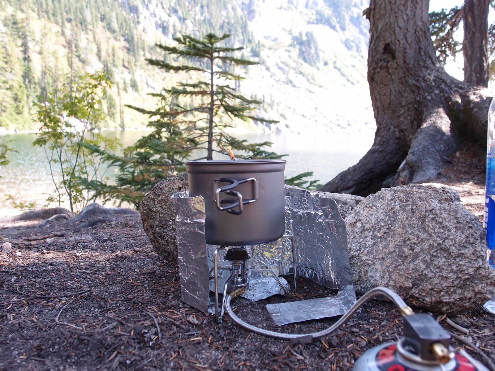
Andy bought us a cool new stove.

Cooling off in the water. Those are Andy's legs - he was doing a handstand but started sinking. You can also see the nice sandy shore in the foreground.

I love Andy!

Stopped for a photo on the way to Lake Janus. Lake Valhalla behind us.

Lake Janus was so nice.

Perfecting the night time pictures.

Caught a shooting start at 4 am.

Morning hike out.

Saturday, August 10, 2013

Rainy Pass to Cutthroat Pass/PCT 2000/Granite Pass

This is a hike I will never forget.

Andy and I have been so busy with the move that we were so excited to plan this next overnight. The weather had been so nice the past several weeks and this weekend was the height of the Perseid meteor shower. Well, wouldn't ya know - thunderstorms and lightning predicted for Saturday night. Right on friggin' cue. No matter, Andy and I still wanted to go since t-storm chance was only "somewhat likely" in the North Cascades versus "very likely" near Rampart Lakes (this was our second choice hike). John and Nicole came with us this trip. This choice of hike was a bit ambitious for their first hike of the season, but I think the views and new experiences were well worth it - right, guys? Luckily, the weather gods gave us beautiful weather on our hike in and out :D We were so lucky and I was so grateful.

The original plan was to start at Rainy Pass, stop for lunch at Cutthroat Pass and then hike the rest of the way to Snowy Lakes and camp in Methow Valley. This would have made it ~11 mile trip. So, after lunch and some exciting events at Cutthroat Pass (!) we made it to Granite Pass and decided it would be best to camp here instead. We set up our tents keeping in mind safe locations if a thunderstorm were to pass (low valley areas with smaller trees) and went on our way to look for water. Fortunately there was a small stream about 0.5 miles father down the trail.

The four of us enjoyed dinner together. FYI - once you stop moving, the mosquitoes are relentless. We used 3M UltraThon DEET lotion to keep the bugs at bay. I got away with 3 bites this year instead of 100+ like last year. Anyways, all throughout dinner we all had our eyes on the sky and after literally putting the second to last bite of dinner in my mouth, a raindrop hit my face. A couple minutes later the rain came down faster so we packed up, reviewed some safety tips if the storm got bad, and headed into our tents. Man, were we in for a show. We may not have gotten a meteor shower show, but we got heavy rain, thunder and lightning. The first storm began at 8 pm and once the rain passed, Andy opened up this rain fly so we could watch the lighting show over the Snowy Lakes/Tower Mountain area safely in our awesome Tarptent. About an hour later, the big daddy storm was right over our heads. Super heavy rain, loud, rolling thunder and 30 strikes of lightning per minute. Yeah, 30 per minutes. It was awesome and terrifying. At one point it got so bad Andy and I suited up in our rain gear and went outside to get in a safer position but as we were huddled in the valley, we looked back at our tent and realized that it was already in a safe location so we went back in the tent and fell asleep to the sound of rumbling thunder and blinding lightning.

Here's a few pics. Aside from the storm, you'll see why this was such an amazing trip :D

Haha this picture always makes me laugh.

Lunch break and photo op at Cutthroat Pass. Gorgeous.

As John and Nicole were finishing up their lunches, Andy and I headed up a little hill to explore and take more pictures.

I was about to head back down because I didn't think John and Nicole were coming up but they were actually on our way so we took a few more pictures of them and us.

I felt like I was standing awkward and was all like "What should I do with my left hand?!" I didn't want to put it on my hip because it's so "pose-y"..

To which Andy replied "I know what you can do with that hand... Marry me."
Yup! We're engaged!!!!! August 10, 2013 :D :D :D (If you get a chance to hear it, Andy's side of the story is hilarious)

*****
Storm clouds rolling in during dinner at Granite Pass.

We have a video of the lightning show, but Andy also got a good pic.

Hike out. You can see how lovely the weather was on our hike out.

The storm was so severe that night that SR 20 west of Rainy Pass was closed due to mudslides and what not. Luckily we were not four of the 65 hikers trapped due to the trailhead washing out. However, SR 20 west was our way home so we had to take a 4.5 hour detour through Chelan, Wenatchee, Goldbar. Took us 7.5 hours to get home. Phew! What a trip indeed.

Wednesday, July 17, 2013

2013 Golite Jam First Impressions

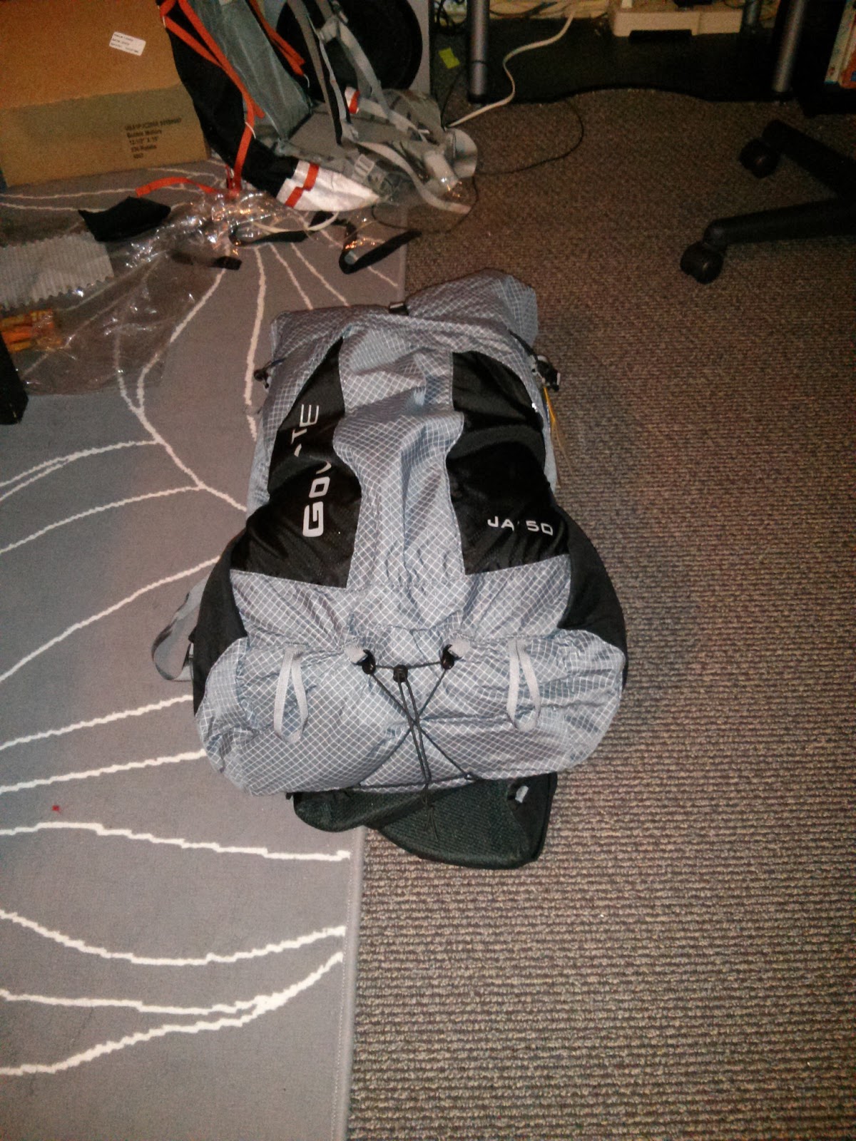
Just got my Medium GoLite Jam 50L (2013) today! Its a pretty sweet, comfortable pack.
I knew the foam framesheet thing was going to be pretty hard/rigid, but I was surprised just how dense/hard it was. More like a foamed plastic than ccf foam.

Specs can be found on GoLite's Site. I'm really liking the hip belt, as it's nice and big with large pockets, and has full wrap around my hips. I also really like the center strip of 3D Spacer Mesh down the back and on the hip belts, as I get swamp back like nobody's business and the mesh should help with that some. Also, the pouch on the front is roomy, and can fit several items even when the main pack is full. The stretch mesh water bottle pockets are nice and large.

The Jam is a frameless pack, and should be fine as is for our normal overnight/weekend trips where my packweight is ~17 lbs with food and water. However, I love to mess around with my gear so...
Added some minor mods right off the bat.
Sewed on some fabric with grommets to the seam just on the other side of the load lifter straps on the inside, and on the sides and tied shock cord to keep a sheet of coroplast (corrugated sign board, pretty much plastic cardboard) in place. The corrugation is oriented so that the board can bend/flex vertically along the curves of my spine, but is rigid horizontally, so the pack won't barrel out when full. The reinforced seam area now comes over the top of the coroplast and securely holds it in place. This allows the load lifters to actually do their job.

Tossed in my quilt (no stuff sack), random cans of soup/broth, water bottles, sleeping pads, etc for a total weight of ~ 22 lbs.

Load lifter straps relaxed, pack pulling back on shoulders
 Load lifters tightened, weight off of shoulders, transferred to hips (although, at this weight, removing the coroplast would allow the pack to conform to my back and carry just as well, don't really even need to use the hip belts for that little weight).
Also added some shock cord to the bottom to have some control of bottom compression instead of the all or none Kompactor system (for reducing volume when using as day pack or carrying less). The side compression straps have opposite male/female buckles, so the left and right straps can be crossed around the front to reduce volume even more, a pretty cool feature
At a load of 20-25 lbs and the stock foam is plenty for me, but the coroplast does make it carry a little nicer, I think (I'll decide after hiking some miles in it). I might hit up Tap Plastics and get some foamed PVC and form it to the shape of my back and see how that works for weights >25-30 lbs. I suppose I don't really need it since I did buy a frameless pack, but it's fun to tinker so, why not?

I'll add final weights, etc. once I cut off excess webbing/straps, etc. and update the review once I take it out on a trip.

Sunday, July 7, 2013

Marmot Pass - Upper Big Quilcene

July 6 - 7, 2013

For the glorious 4th of July weekend, an overnight hike was in order. Andy, equipped with his new camera and skills, was inspired by Coleman's trip report and beautiful pictures. So that's where we (and a bunch of other hikers) decided to go!

The trail head was nearly full when we arrived Saturday morning around 9:30 am. Certainly a steady and gradual climb up to the top. It was our first time at the pass and it sounded like most of the people who where already camped out make it a point to come regularly. I now know why and maybe we will be regulars, too. Who would expect a lush meadow at the top of the ridge? We found a nice flat spot to pitch our tent. Other than the large flies, bees and ants, there were no other annoying bugs around. I think a few mosquitoes because I have one bite, but not bad at all. There were still some patches of snow at the top and that's how we got our water - let the ice melt in the sun, filter, then boil. There appeared to be red sediments on the surface of the snow, so we just dug a little deeper to get some fresh snow.

It's awesome up there - especially at 6,100' on a clear, not too cool night. The stars made a spectacular show and Andy took some cool pictures. Oh my gosh! And we saw our first large, male goat. Mild mannered, but he was getting too comfortable around our sites so some of us had to throw rocks at him to scare him away. He was grazing and following people as they went pee. Looking for urine, that guy.

When we come back next time, we will make it a point to climb up to Buckhorn. It must be spectacular up there.

Walking along the ridge at the top of the pass.


Waiting for the sunset with Andy, camp neighbors, and goat.


Sunset

Thee Milky Way

Sunday, May 5, 2013

Baker Lake

May 5, 2013

This was a relaxing day hike on a gorgeous 75-80° day. The trail is nothing spectacular - relatively flat with the lake just out of reach, but the views of Mt. Baker were amazing. Too bad I have a crappy camera. We ended up using the camera on our phones.

After 4.5 miles, we stopped to have lunch at a campground. There were a few people there (and an adorable corgi), but we found a spot by the lake. On our hike out, we were planning on which beach to head to and started dreading the traffic to anywhere in Seattle on a sunny day. Then, Andy remembered seeing a washout area earlier in the hike that would make a nice spot to lay out in the sun. Good thing I brought my swim top. We ended up taking a detour to that spot right on the lake and laid out for an hour or so. Happy Angela.


Posing at our lunch spot.

Sunday, March 31, 2013

Ozette to Norwegian Memorial

March 28 - 29, 2013

To be honest, this was not the beach/coast hike I expected. The hike into Toleak Point is mostly in the woods, so we decided to try a different beach hike that was along the coast the whole way. I don't think the hike from Ozette to Norwegian Memorial is very popular, though, because it's not really a beach hike..

From the Ozette Ranger Station we took Sand Point Trail down to Sand Point. Sand Point Trail is 2.8 miles along well maintained boardwalk. Careful, it's slick when wet.


Boardwalk

SP Trail spit us out at Sand Point on the sandy beach.


Tiny human.

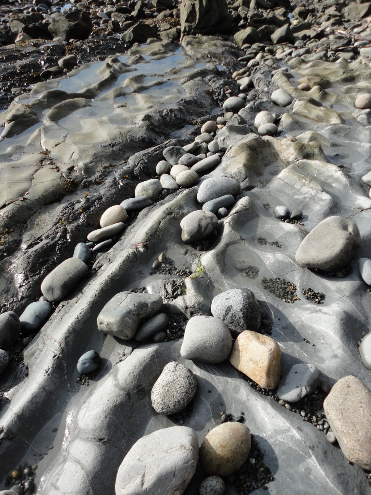
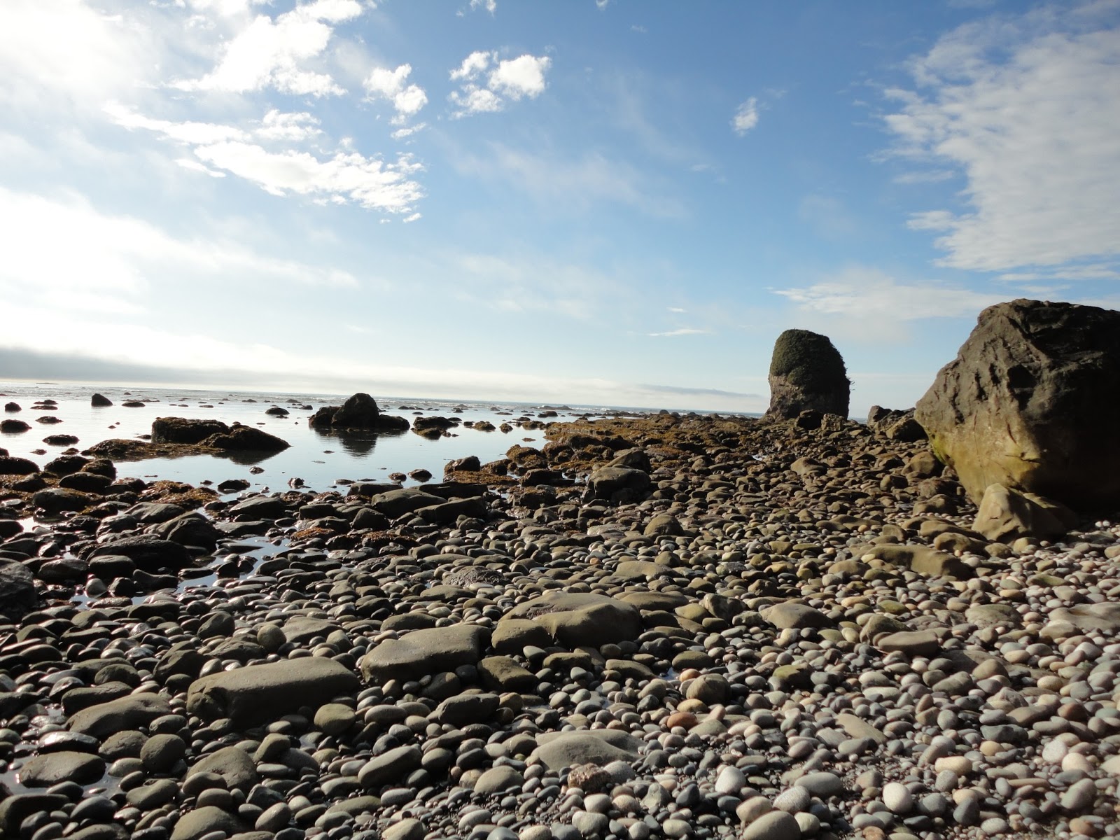
After 1-1.5 miles of walking on along the beach, the remainder of hike was rocks, rocks, rocks. A tide chart is essential because there are four areas that will be impassable at high tide. The 9.3 mile hike took us longer than expected because most of the time we were navigating and scrambling over wet, slippery rocks and fallen trees. Actually, we started our hike around medium tide since the Wilderness Information Center in Port Angeles didn't open until 8 am. I think you're able to get permits at the Ozette Ranger station.. Something to remember in the future.


The weather was nice for us. There were both times of fog and bright sunshine.


Seastack


The best part of the trip for me was seeing all the eagles. So many eagles! What a cool national bird.


Took a lunch break while waiting for the tide to go out. We made our own meal this trip!! So exciting :) We dehydrated rice, ham, acorn squash, roasted tomatoes and onions. I don't recommend dehydrating ham. It doesn't fully rehydrate and can either be chewy or slightly crunchy. But, it was still delicious and filled us up.


So cool


Low tide rocks and sun.


We had the ENTIRE beach to ourselves and chose an awesome camp site.


Heading out to get water at a nearby stream.


Sunset dinner on the beach <3


I didn't take a picture of the memorial, but it appears to be in good shape :)
Our hike out was much easier than our hike in. We packed up and left camp at 7:45 am. Low tide was at 7:50 am. We still had to navigate slippery rocks, but much less climbing over and under trees and over large rocks. The hike back took 5 hours versus the 7 hours in.