Sunday, October 8, 2023

Silver and Twin Lakes

October 7-8, 2023

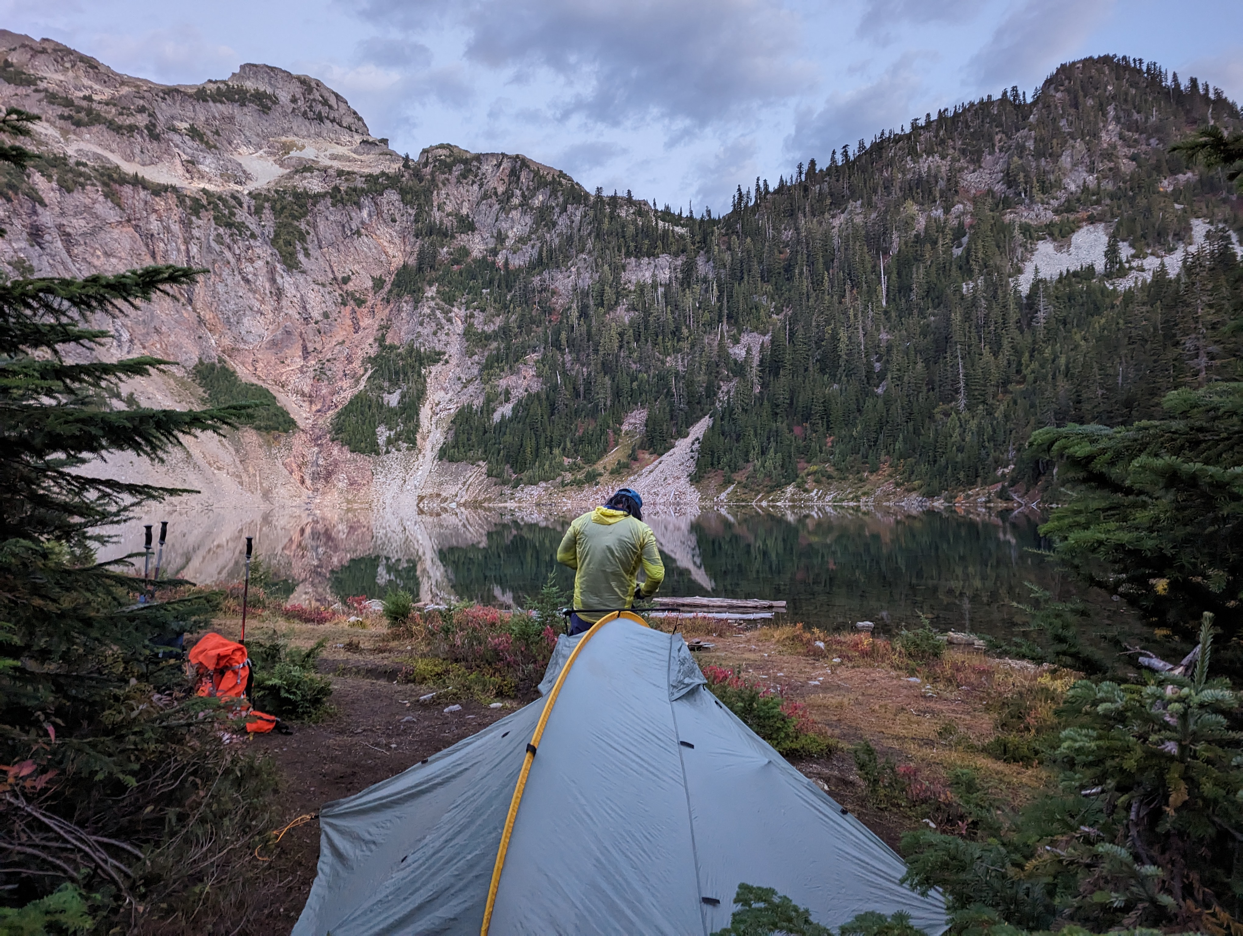
With my favorite backpacking season upon us, I was itching to do an overnight somewhere.. anywhere! Originally thought it'd be cool to see the larches and check out Lake Ingalls, but probably so did hundreds of others so we opted out of that one for now. Instead, off to Twin Lakes we went early Saturday morning. The lot was full by the time we arrived at 9 am and we managed to get the last parking spot. Toilet is available at the TH and NW Forest Pass is required. The hike starts at the same trailhead as Gothic Basin where we hiked in 2016. Signage has definitely been updated or added since we were last here. There's no way we would've missed the turnoff to Gothic Basin this time around. But this time we intentionally passed it on the way the Monte Cristo town. We saw a few groups hiking to the abandoned town and no further than that. We had the trail entirely to ourselves the rest of the day, which is crazy considering the warm weather all weekend and the full parking lot.


It's an easy flat 4 miles to the abandoned town. Some folks opt to bike this trail and there's a bike rack located in town. We spent a couple minutes looking at the signboards and continued through to Poodle Dog Pass which was a steep climb of 1500' over 1.9 miles. Fall foliage and nicely constructed boardwalks distracted me from the harsh elevation gain and my ageing knees.


At Poodle Dog Pass we had the option to take a 0.4 mile detour to Silver Lake, but decided to continue on to Twin Lakes. Once again we began to climb, then descended a concerning amount, and then climbed back up again. This dang trail! There was definitely some swearing and a lot of keeping my head down so I didn't see the steep and endless climb ahead. The view above Twin Lakes was indeed spectacular. Route finding was tricky here.


Sadly, route-finding was again tricky down to the lakes. We misinterpreted the map, took a left a little too early and followed some untrustworthy cairns. This lead us to an impassable talus/scree field where Andy slid several feet and luckily was able to save himself from sliding with the river of rocks down the cliff. That was enough for us to turn around. Exhausted, hot, and hungry we had lunch with a view of the lakes while rethinking our overnight plan.


With no spots to pitch a tent, a few hours until sunset, and a couple liters of water remaining, we decided to play it safe and back-track to Silver Lake. There we would be able to filter more water and nab an established campsite. Back home now looking at the map, we know where we missed the drop off prior to turning left. It certainly wasn't obvious when we were out there. Good thing we played it safe and didn't continue on the path we were on. We'll have to revisit this one another time.

At Silver Lake we heard two voices. Finally, people! A couple who just came from Twin Lakes. We chatted a bit and both were surprise at the solitude on this hike.

Silver Lakes was a lovely camping spot. After a long 7 hours of hiking 11 miles, Andy and I took our time and enjoyed the rest of the evening outside sipping cocoa and stargazing. 


One of the positives of back-tracking and camping at Silver Lake instead of Twin Lakes is that it made the hike out on Sunday much easier as the bulk of the difficult elevation climb was past us. We had a nice reflective hike back down and quickly set our sights on après beers.


Saturday, August 26, 2023

Larrabee State Park - Fragrance Lake

August 26, 2023

One of my favorite trips to take lately is up to Bellingham. A typical day trip for us is going on a hike in the morning, then explore town. We visited Larrabee State Park this time around and hiked a nice loop to Fragrance Lake. Lots of little private spots to dip your feet and Toby and Mario in. This was a perfect one for the boys. They enjoy hiking as much as we do.


Wednesday, July 26, 2023

Mt. Si

July 26, 2023

I'm only realizing now that I've hiked Mt. Si more than any other area. Funnily enough I haven't been here with Andy or the pups. It's convenient to get to so there's almost always other hikers around, making me feel safe when I hike it myself, though it's always nice to hike with a friend.


Monday, July 3, 2023

Padilla Bay

 July 3, 2023

With the 4th of July holiday falling on a Tuesday this year, we decided to take Monday off and enjoyed a long and sunny four day weekend. In an attempt to tire the pups out before heading to a couple nearby breweries we thought it'd be a great idea to walk along Padilla Bay. It's a straight-forward, dusty level path along the bay. Nothing too exciting other than it being very windy and hot that day. 


Saturday, January 28, 2023

Coal Creek Falls & Doughty Falls

January 28, 2023

Wow! We ended up hiking with the pups every weekend in January and I'm super proud of them. We've hiked from this trailhead at Cougar Mountain a couple times before, but with such an extensive trail system we were able to make a new, 7.8 mile loop out of it. 

We started at the Sky Country Trailhead at 11:00 am on a Saturday. There was still plenty of parking available with a handful of people leaving as we arrived. No pass is required.

Puppy parade!

There were a good amount of people hiking and running, but the trail never felt crowded. Lots of good doggos off leash, too. We decided to give Toby a try at hiking off leash and he did great!

Andy mapped out a great loop, taking us to Cougar Mountain Lookout, Doughty Falls, and Coal Creek Falls. Turns out I didn't take many pictures this time around.

Water break

"Official geocache"

Coal Creek Falls

That's about it! Nothing too exciting, but the pups sure had a great time. We stopped by Formula Brewing for some après hike beers and pizza then headed home for a nap to dream about the day 😊

Sunday, January 22, 2023

Lizard & Lily Lakes

January 22, 2023

Though it was a rainy Saturday, Sunday was dry and cloudy so we harnessed the pups, packed our water and snacks, and headed to Samish for a day hike up to Lizard and Lily Lakes. 

The road to both the Blanchard Mtn lower and upper trailheads were well maintained with few potholes. From what I could tell, only the lower lot had facilities. It's <1 mile between the upper and lower lots but there was still plenty of parking at the upper lot at 10 AM on a Sunday so we parked there. A Discover Pass is required. There's signage and maps at the lot to help orient yourself.

From the parking lot, there are three directions you can go: to the lower lot, to the Alternate Incline Trail, or to Lily/Lizard Lakes. We walked briefly down the road we drove up to the Lily/Lizard Lake TH. 

At the trailhead there was a sign indicating the WTA trail crew was at work. Thank you WTA!! They were doing an awesome job. 

The fog persisted through most of the hike, which made for beautifully eerie surroundings. There was a dusting of snow in areas and at the lakes. We packed a liter of water for Toby and Mario, but small flowing streams were scattered along the hike which made great hydration stations for the pups as well.


It was a steady gentle climb until we arrived at the split for Lily Lake Trail or Lily Lizard Trail. We decided to continue on the Lily Lizard Trail. At this point the trail was flat to Lizard Lake. There are benches and fire pits. This designated camp area provided a nice spot for us to take a quick snack break.

Lizard Lake

Lizard Lake camp area

Mario admiring the benches and fire pits at Lizard Lake

My boys <3

After Lizard Lake, we headed to Lily Lake. Along the way I took a picture with a huge rock.

Huge rock pose

We only passed by Lily Lake.

Trail along Lily Lake


Feeling good and with the pups still energized, we decided to make this an even longer hike by taking a detour to check out Samish Overlook. Though the trail connects to Oyster Dome, we'd already been to Oyster Dome a few years back and wanted to check out a new spot. Part of the hike up there was along a newly constructed gravel road so we had to watch for cars. The area appears to still be in the works. Part of the way up, there were cars parked along the side of the road. We didn't go all the way up to the overlook point because the pups looked like they were getting tired and we still needed to hike back down. Luckily for us the weather seemed to clear just as we approached a clearing not far from the overlook point.
Section of Henry's (?) Trail heading to the new road

Clouds rolled away for a few minutes near Samish Overlook. Lucky us!

Clouds rolled in once we got back up to Henry's Trail. What good timing for us.

On the way down we took Max's Shortcut and the Lily Max Connector. All in all we hiked 11 miles in 3.5 hours. I really enjoyed this one and am so proud of Toby and Mario!

Après hike beer and pizza at the dog-friendly Terramar